Archives
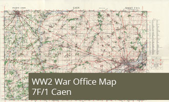
7F/1 - Caen - War Office Map (1:50,000)
Category: Maps: GSGS 4250
Tags: Map
WW2 Map 7F/1 Caen shows the City of Caen in the East and Bayeux in the West showing the area inland of the British and Canadian landing beaches
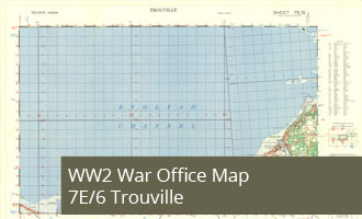
7E/6 - Trouville - War Office Map (1:50,000)
Category: Maps: GSGS 4250
Tags: Map
WW2 Map 7E/6 Trouville shows the Normandy coast East of the Sword Beach from Houlgate to Trouville
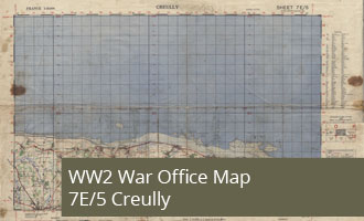
7E/5 - Creully - War Office Map (1:50,000)
Category: Maps: GSGS 4250
Tags: Map
WW2 Map 7E/5 Creully shows the Normandy coast between Lion-sur-Mur and Le Mesnil covering most of Sword Beach and Juno Beach and all of Juno Beach.
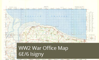
6E/6 - Isigny - War Office Map (1:50,000)
Category: Maps: GSGS 4250
Tags: Map
WW2 Map 6E/6 Isigny shows the Utah Beech and Omaha Beach landing areas on the Normandy Coast.
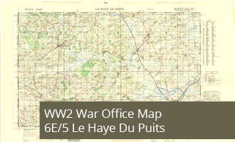
6E/5 - Le Haye Du Puits - War Office Map (1:50,000)
Category: Maps: GSGS 4250
Tags: Map
WW2 Map 6E/5 Le Haye Du Puits shows the area between Utah beach and the Cotentin Peninsula including the towns of St Mere-Eglise and Carentan