Archives
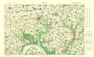
8E/4 - Yveto - War Office Map (1:50,000)
Category: Maps: GSGS 4250
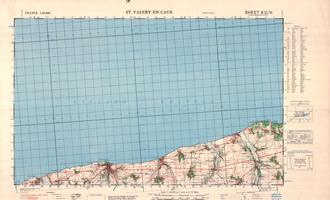
8D/6 - St Valery-en-Caux - War Office Map (1:50,000)
Category: Maps: GSGS 4250
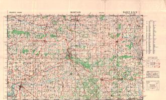
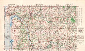
6F/3 - Coutances - War Office Map (1:50,000)
Category: Maps: GSGS 4250
WW2 Map 6F/3 – Coutances, depicts the south west of the Cherbourg Peninsula.
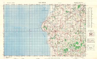
WW2 Map Sheet 5E/4 – Les Pieux Normandy (GSGS 4250 Series)
Category: Maps: GSGS 4250
WW2 Map 5E/4 – Les Pieux, covers the eastern edge of the Cherbourg Peninsula around Les Pieux.
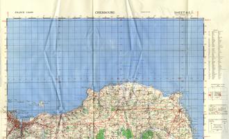
WW2 Map Sheet 6E/1 – Cherbourg, Normandy (GSGS 4250 Series)
Category: Maps: GSGS 4250
WW2 Map 6E/1 – Cherbourg, depicts the eastern tip of the Cherbourg Peninsula.
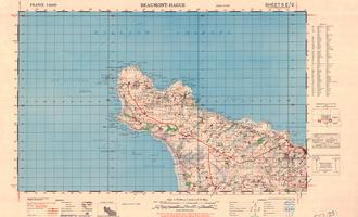
WW2 Map Sheet 5E/2 – Beaumont-Hague, Normandy (GSGS 4250 Series)
Category: Maps: GSGS 4250
WW2 Map 5E/2 – Beaumont-Hague, depicts the eastern tip of the Cherbourg Peninsula.
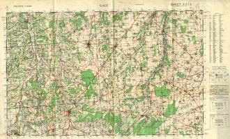
8F/5 - Gace - War Office Map (1:50,000)
Category: Maps: GSGS 4250
WW2 Map 8F/5 - Gace shows the Normandy towns of Gace, Vimoutier and le Sap
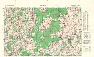
8F/6 - Breteuil - War Office Map (1:50,000)
Category: Maps: GSGS 4250
WW2 Map 8F/6 - Breteuil shows the Normandy towns of Breteuil, La Neuve Lyre and Rugles.
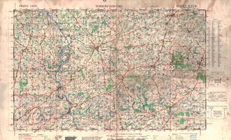
6F/4 - Torigni-Sur-Vire - War Office Map (1:50,000)
Category: Maps: GSGS 4250
WW2 Map 6F/4 - Torigni-Sur-Vire shows the Normandy towns of Torigni-Sur-Vire, Cahagnes, Caumont and Tessy-sur-Vire.
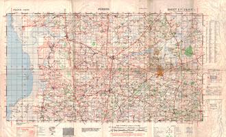
5F/2 & 6F/1 - Periers - War Office Map (1:50,000)
Category: Maps: GSGS 4250
WW2 Map 5F/2 & 6F/1 featuring the Normany towns of Periers, Lessay, Lendelin, Geffosses and Marigny