Archives
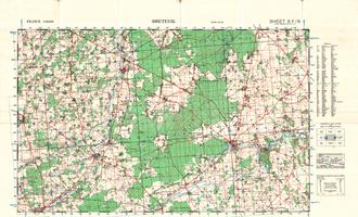
8F/6 - Breteuil - War Office Map (1:50,000)
WW2 Map 8F/6 - Breteuil shows the Normandy towns of Breteuil, La Neuve Lyre and Rugles.
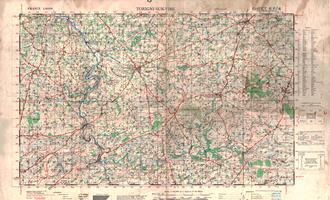
6F/4 - Torigni-Sur-Vire - War Office Map (1:50,000)
WW2 Map 6F/4 - Torigni-Sur-Vire shows the Normandy towns of Torigni-Sur-Vire, Cahagnes, Caumont and Tessy-sur-Vire.
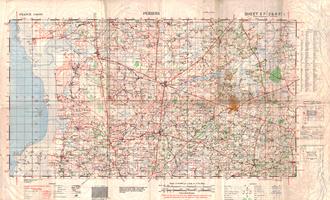
5F/2 & 6F/1 - Periers - War Office Map (1:50,000)
WW2 Map 5F/2 & 6F/1 featuring the Normany towns of Periers, Lessay, Lendelin, Geffosses and Marigny
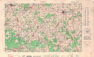
8G/2 - Verneuil - War Office Map (1:50,000)
WW2 Map 8G/2 - Verneuil featuring the Normany towns of Verneuil, Laigle, Crulai, Maurice-les Cherencey and La Ferte Vidame
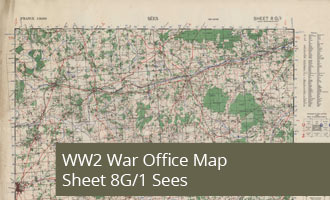
8G/1 - Sees - War Office Map (1:50,000)
WW2 Map 8G/1 - Sees featuring the Normany towns of Sees, Courtomer, Moulins la Marche and Nonant le Pin
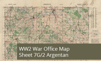
7G/2 - Argentan - War Office Map (1:50,000)
WW2 Map 7G/2 - Argentan shows the Normandy towns of Argentan, Montree, Ecouche centered on Bouce.
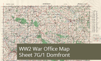
7G/1 - Domfront - War Office Map (1:50,000)
WW2 Map 7G/1 - Domfront shows the Normany towns of Domfront, La Fert-Mace and Briouze.
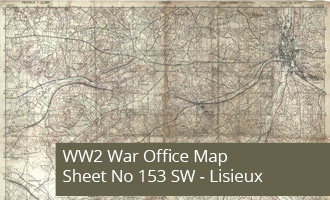
GSGS 4041 Map - Lisieux France, Sheet No 153 SW
GSGS 4041 Map of Lisieux France, Sheet No 153 SW. - 1:25,000 Edition May 1944

GSGS 4347 Map - Cheux France, Sheet 37/16 S.E.
GSGS 4347 Map of Cheux France, Sheet 37/16 S.E. - 1:25,000 Edition July 1943
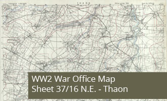
GSGS 4347 Map - Thaon France, Sheet 37/16 N.E.
GSGS 4347 Map of Thaon France, Sheet 37/16 N.E. - 1:25,000 Edition June 1943
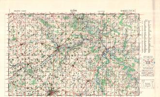
7F/5 - Flers - War Office Map (1:50,000)
WW2 Map 7F/5 - Flers shows the Normandy area centered on the town of Conde sur Noireau inland from Aunay sur Odon
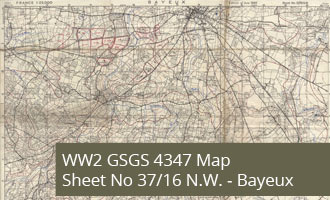
GSGS 4347 Map - Bayeux France, Sheet 37/16 N.W.
GSGS 4347 Map of Bayeux France, Sheet 37/16 N.W. - 1:25,000 Edition June 1943