normandy
warguide
Explore
War Diaries
Archives
Articles
Tools
▾
Co-Ordinate Converter
Register
Login
Archives
Categories
Maps: GSGS 4250
Maps: GSGS 4347
WO 195: Ministry of Defence and predecessors: Advisory Council of Scientific Research and Technical Development
WO 223: War Office: Staff College Camberley, 1947 Course Notes on D-Day Landings and Ensuing Campaigns
SUPP 15: Flame Warfare Committees: Minutes and Reports
Maps: GSGS 4041
Tags
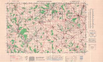
Map
10E/3 - Crevecoeur-le-Grand - War Office Map (1:50,000)
Category:
Maps: GSGS 4250
Tags:
Map
10E/1 - Conty - War Office Map (1:50,000)
Category:
Maps: GSGS 4250
Tags:
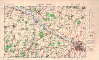
Map
10D/5 - Molliens - Vidame - War Office Map (1:50,000)
Category:
Maps: GSGS 4250
Tags:
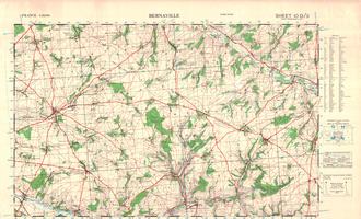
Map
10D/3 - Bernaville - War Office Map (1:50,000)
Category:
Maps: GSGS 4250
Tags:
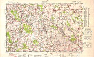
Map
9E/4 - Forges - War Office Map (1:50,000)
Category:
Maps: GSGS 4250
Tags:
Map
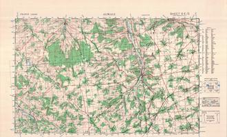
9E/2 - Aumale - War Office Map (1:50,000)
Category:
Maps: GSGS 4250
Tags:
Map
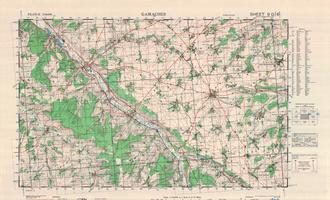
GSGS4250 9D/6 - Gamaches - War Office Map (1:50,000)
Category:
Maps: GSGS 4250
Tags:
Map
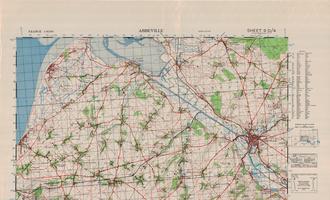
9D/4 - Abbeville - War Office Map (1:50,000)
Category:
Maps: GSGS 4250
Tags:
Map
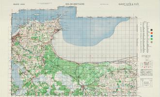
5G/2 - Dol de Bretagne- War Office Map (1:50,000)
Category:
Maps: GSGS 4250
Tags:
Map
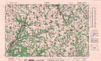
9E/3 - Cleres - War Office Map (1:50,000)
Category:
Maps: GSGS 4250
Tags:
Map
9E/1 - Neufchatel - War Office Map (1:50,000)
Category:
Maps: GSGS 4250
Tags:
Map
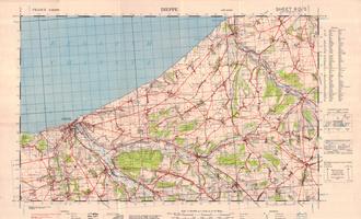
9D/5 - Dieppe - War Office Map (1:50,000)
Category:
Maps: GSGS 4250
Tags:
Map
‹
1
2
3
4
5
6
7
8
›